Friday 31 March 2017

Cork City

It is 2:00 am and we just wandered back to our apartment in Cork after a night out on the town.  As far as cities go, this is a very good one.  The people in Cork are really great.

It was a travel day with lots of stupid stuff happening.  Our Tesco SIM card expired today, but we did not know it, as I missed their text from last night.  Just when I went to text the owner of our apartment to let him know when we would arrive, I figured out we no longer had cell service.  So we had to find a Tesco in Cork to top up the SIM card, but the GPS was dropped and smashed yesterday so we cannot use the screen very well and have to keep shutting it down.  We missed the turnoff to Tesco and then when we did get there, the parking lot was packed at 10:00 am and a total zoo.

Then the cell phone guy that mans the kiosk was late.  We got the top-up and then I could text the apartment owner to let him know that we would be late arriving due to the cell phone fiasco.  After meeting the owner and dropping off our luggage, we had to take the rental car to a depot in Cork and, as we were driving there, we realized we forgot to fill it with fuel, which is a must or they absolutely hammer you with a fuel charge.  We found a gas station which had an awesome car wash, so we washed the car as well, as it was pretty dirty after a month of driving.

We walked from the car rental place toward the centre of Cork and stopped for a cappuccino in a dumpy little breakfast place.  The owners thought we were Americans, and then went ballistic when we told them we were Canadians, and a long conversation ensued.

Then we headed to the city centre to the English Market which is a meat/fish lover’s paradise.  There were so many butchers there, we made the rounds a few times before we decided which one to stop at.  Our main criteria is to select one that is staffed by old men, there are a lot of butchers with old men at this market.  We finally stopped and got the best service imaginable and the best pork belly we have ever eaten.

An older woman was buying an entire pork belly, so I asked her what she was doing with it.  She had the butcher cut the top bone part off and then he made cuts in the rind and then rolled the whole thing and tied it with string.  She is going to roast it for 3 hours to crackling stage and then slice it.  It was a thing of beauty and I went on and on about it

Then we got a few more groceries and attempted to find our apartment on foot.  As is usual, we totally overestimate how far to go, and we overshot our street by some km, which sounds crazy, but we always do this in cities, and never learn.

We asked a local man where we were and how to get to our street and I handed him our crappy tourist map.  He said we were off the map and told us to walk up this huge hill and turn left at the top of the hill, which we did, and his directions were perfect.

The River Lee runs through Cork, so it is basically a valley with steep hills on either side of the river.  The people who live here will have legs of steel from walking the hills.  The bus strike is still on, so they all are on foot.

When we finally got back to our apartment, we had tea and cooked dinner then went out for some night photography.  After that, we went to this incredible bar that was packed, and had a band playing.  When that first band finished, another band set up and started playing.

There are locals and visitors from all over the world in the bar, it is just a terrific place and we had a total blast.  Then we walked home and people on the streets were just ripped.  This is a real party town and there is music playing everywhere and people sing on the streets as they walk home from the bars.

Cork At Night


The History of Ireland Continues...

Anglo-Irish Agreement of 1985

The political process moved along at a slow pace.  Finally, there was an agreement which included a role for the Republic of Ireland, where the Republic was given a consulting role in parts of the government of Northern Ireland.  As part of the agreement, no change in status of Northern Ireland could take place without the consent of the majority.  Also, Britain would not block a united Ireland if that is what Northern Ireland wanted.

The Unionists hated the agreement as they viewed it as a betrayal by the British government.  A one day strike was called, which essentially shut down all business and industry in Northern Ireland.  Rioting broke out and paramilitary groups killed Catholics.

In the 1990s, the Republic of Ireland was moving on, society had modernized and the very powerful Catholic church was disgraced, due to the abuse of children by priests and the decades long cover-up of such horrendous behaviour.  The economy was strong and there was actual immigration for a change.  It was Northern Ireland that was not modernizing, as the country continued to be locked in sectarian violence.

Things dragged on and on with little headway being made politically.  Then a killing spree erupted from 1990 to 1994 by both the IRA who carried out bombings in London and unionist paramilitary groups killing in Northern Ireland.  The war of killing and retaliation had to come to an end.  President Clinton defied his own cabinet and the British government, and issued a US visitor’s visa to Gerry Adams, the leader of the Sinn Fein.  This got the attention of the IRA and in August 1994, they declared a commitment to the peace process and would discontinue military operations.

However, things did not speed ahead, nothing was settled and the IRA viewed British Prime Minister John Major as a puppet of the unionists.  The cease-fire ended when the IRA bombed Canary Wharf in London in February 1996.

In 1997, Tony Blair and his Labour Party won a landslide in the British election.  Blair, Clinton and Ahern of the Republic of Ireland were all committed to the peace process and pressed ahead with talks.  In July of 1997, the IRA declared a cease-fire.

Thursday 30 March 2017

Torc Mountain Walk

Since tomorrow is a travel day, and we have a lot of chores to do, we opted to stay reasonably close to Kenmare for today’s outing.  Also, we needed to find a low level mountain, due to the forecast of clouds and showers.  Torc Mountain is to the north of us in Killarney National Park, a place that we would normally avoid, as it is a popular tourist destination.

The road from Kenmare to Moll’s Gap is closed, so we have to take a guess at which narrow road to take to reach the Gap, so that we can continue toward Killarney.  Today we happened upon a really good route that made for a speedier trip.

En route to Killarney National Park there are some pretty good views of the lakes in the park.  We parked in a lot that is near to the Torc Waterfall which draws a lot of people.  The path up to the waterfall is constructed like a freeway.

After stopping briefly at the falls, we continued on to walk up Torc Mountain.  Torc Mountain is so popular that they have laid railway ties covered with hardware cloth up the mountain to prevent erosion.  The remainder of the trail is rock, which is a lot better than walking along railway ties.

When we reached the summit, a couple of young Germans were up there so we talked to them for quite some time about travel.  The Germans travel a lot, so we asked them where they have been and where they are planning to travel in the future.  Last summer, they visited BC and Alberta and did some hiking.  They thought that Canada was very expensive, with the exception of fuel.

As we were about to descend, a big squall came in with wicked wind and rain, so we tore off like bandits to get down the mountain as fast as we could.  Although, this is not our type of mountain to walk, it was perfect for today as we got back to Kenmare at a reasonable time for a change.
We are off to Cork city tomorrow, where we will return the rental car; therefore, we will have to slow down or make our way around on foot or by public transit.  However, one of the major bus companies is going broke and their workers are currently on strike.  We will be in Cork for three nights before heading back to Dublin to fly home, and it has all gone by too fast, ack!

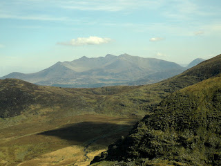
Our destination:  Torc Mountain in the distance

View of Upper Lake, Killarney National Park

Torc Waterfall

View from summit of Torc Mountain

View of Muckross House from Torc Mountain

The History of Ireland continues...

More Troubles, 1973 - 1980

The IRA began to target the British army with car-bombs which caused many casualties; they also bombed shops in Northern Ireland cities and towns, killing civilians.  In retaliation, Unionist death squads patrolled the streets of Northern Belfast and the roads of mid-Ulster, killing Catholics, one such group called themselves the Shankhill Butchers.

Membership in the IRA was illegal, but membership in the unionist paramilitary group, the Ulster Defence Association was perfectly legal until 1992; even though the group was responsible for killing Catholic civilians.  The IRA began bombing in England and killing politicians.

The legal proceedings regarding the arrest of paramilitary suspects was changed.  Previously, suspects were political prisoners, now they would be tried in open court as criminals, but did not receive jury trials and the evidence required to convict was not as rigorous.  Several IRA prisoners went on a hunger strike and demanded they be allowed to wear their own clothes and not prison issue.  One of the hunger strikers, a prisoner named Bobby Sands ran for election for a Northern Ireland seat in the British Parliament while in prison on a hunger strike.   He won his seat but Prime Minister Thatcher would not meet any of the demands, Bobby Sands and nine other prisoners died of starvation.  Shortly after this incident, prisoner of war status was restored to political prisoners.  Sympathy for the hunger strikers in Ireland and around the world was substantial.

Troubles Continue

Sinn Fein became politically active and took 13% of the vote in the 1983 general elections in Northern Ireland.  The war between the IRA and British security forces continued in the 1980s, although the death toll was a fraction what had occurred in the 1970s, with the total less than 100 deaths throughout the 1980s and 1990s.

Wednesday 29 March 2017

This, Is Ireland

As it was time for something completely different, we drove away from the sea, and into the heart of Co. Cork to the Lee Valley, where the River Lee runs through to Cork City.  This is a landscape of trees, shrubs, dairy cattle, grazing land and crop land.  This land is also dotted with many ruins, to which, we are forever drawn.

The ruins are not signposted, so we had to sleuth them out, by scanning the landscape, by studying the rivers, by looking at our inadequate maps and by guessing which little road to drive down next.  We were forced to slow down, as it takes time to look, time to see, and time to appreciate what was right there surrounding us.

Our first stop was the market town of Macroom, which sits on the banks of the River Sullane.  The castle was built by the O’Flynn family in the 12th century.  The O’Flynn’s were defeated by the McCarthy’s, and they held the castle until the mid 17th century.  When Cromwell was waging war in Ireland, the Castle and most of the town were burned; eventually, Cromwell gifted it to one of his friends.

Macroom is a real Irish town, where the shops advertise that ‘girls confirmation dresses are now in’, where the book store does not carry a tourist book, where many shop windows have a lovely Easter display and where the coffee shop is frequented by locals.  The patrons consisted of: old men having tea or coffee and cake; where a mom and her son, dressed in his school uniform, had latte for her and a sweet drink for him; an elderly man and woman having cappuccino and cake and afterwards, she bought an entire fruit loaf for less than the price of two cappuccinos and where John and I basked in the ordinariness of it all.

Brightly painted shops in Macroom

Gateway and Tower - Not Ancient

Macroom Castle

Bridge over River Sullane

Macroom Castle

Murphy's, the choice of Cork stout drinkers 


We drove east of Macroom and embarked on our hunt for ruins.  After driving through the same town about three times, trying every road, we finally found the correct little river, the Dripsey, which flows through the town of Dripsey, but the castles were out of town, down the last road we could find.

The wonderful ruin of Carrignamuck Castle sits high above the Dripsey River in the trees.  Just upstream is the private Dripsey Castle, which cannot be seen from the road.  Only the ornamental tower and the gatehouse are near the Dripsey River, next to a wonderful bridge.

Carrignamuck Castle

Dripsey Castle Gatehouse

We then found the Kilcrea Castle and Kilcrea Abbey quite easily, as there was a sign off the main highway.  The Castle sits among overgrown trees in the middle of a field.  There is a trail through the field, even when it is in crop.  The field was in some type of cereal crop last season, but the sketchy straw indicates that the crop was not a good one.  We walked through an opening in the stone wall and through the field to the ruin.  This is a really great ruin, which is only inhabited by birds.  There would have been a lot of activity here in days long past.

We walked all around the Castle in a field of water saturated grass, so that we could get photos from every conceivable angle.  We had to jump a stream as well, but this is why one should never set foot outdoors in Ireland without waterproof hiking boots.

Kilcrea Castle


The Kilcrea Abbey is across the road, so we walked back through the field to the Abbey ruin, which sits in another field, but the Abbey is fronted by a grassy approach through the trees.  The Abbey is a splendid ruin that provides a lot of opportunity for really good photos.

Kilcrea, meaning, Woman of Cre, for the woman, who founded a hermitage prior to the Franciscans founding the Friary in 1465.  This is reported to be a very good example of an Irish Franciscan monastery.

Kilcrea Abbey


This landscape of mountains, hills, misty river valleys, ruins, history, fields, cattle and ordinary towns is what Ireland is really about.  If you ever find yourself in Ireland, flee from the tours, the kitsch, the shopping, the must see lists - get out and lose yourself in the land, where you will find something else.

Tuesday 28 March 2017

The Beara Peninsula

This is a wild and raw landscape that is devoid of tourist buses and tourists at this time of year.  The roads are narrow, thus preventing the tourist bus onslaught that takes hold of the Ring of Kerry.

The high pressure system that gave us days of clear skies and abundant sunshine has vanished.  We are back into unsettled conditions and woke up to rain this morning as the mountain tops vanished under heavy cloud.  We are resigned to having to partake in low level activities.

We set out on the Beara Way drive along the north side of the Beara Peninsula.  Upon reaching Castletown Bearhaven, we stopped at a coffee shop for a very good cappuccino, the best since we were in Ballybofey in Donegal, which feels like ages ago.

There is a very long walking path, referred to as the Beara Way which runs for 206 km through the Beara Peninsula.  As there was a break in the rain, we stopped in Adrigole to walk a small portion of the footpath.  This proved to be an abysmal walk, as they seem to be in the process of upgrading an overgrown section through forest.  A wide swath of trees were plowed down, leaving an uneven mucky mess.

Then the path went through bog where we could sink to our knees if we were not careful.  Finally, the path continued on a narrow paved road which led to nothingness, and that is where we turned around.

However, there are some fantastic mountains on Beara that are made up of huge slabs of rock.  An incredible road, called the Healy Pass, winds its way up to the border between Co. Cork and Co. Kerry, between the mountains of Hungry Hill and Knockowen in the Caha Mountains.  Luckily for us, there was virtually no traffic on the narrow, twisty road when we drove up.

On our way back to Kenmare, we drove on a tiny road to the Uragh Stone Circle.  The stones are sited in a beautiful landscape between two lakes, with mountains and a waterfall as a backdrop, it does not get much better than this.

Beara Peninsula Coastline

Ruined Church

Adrigole Mountain

Healy Pass Road

Glanmore Lake

Healy Pass Road

Uragh Stone Circle


The History of Ireland Continues....

In the 1970s a war raged between the newly emerged Provisional IRA and the British army, along with the RUC and the Ulster Defence Regiment.  Between 1971 and 1974, bombings, shootings and murders were a daily occurrence.  The political structure began to collapse as the Unionist Party split into the Official Unionist Party and the Democratic Unionist Party (DUP), led by Paisley and other fringe loyalist parties.  On the nationalist side was the Social and Democratic Labour Party (SDLP) and Sinn Fein, a Catholic party which later became the political wing of the Provisional IRA.

The Dublin leaders of the original IRA, were Marxists, they did not respond to the repression of the Norther Ireland Catholics by the RUC.  Therefore, the Belfast republicans and southern non-Marxist IRA members, established a Provisional Army Council.  At the Sinn Fein congress, there was a split in the IRA, the Official IRA retained a Marxist ideology and military aim, while the remaining members became the Provisional IRA and declared themselves to be the defenders of the Northern Ireland Catholics, many were IRA veterans.

Initially, relations between the Provisional IRA and the British army were quite good as the Catholics regarded the army as protectors.  However, everything fell apart due to several issues:

1.  A Falls Road curfew was enforced in 1970, people were ordered to stay home and the British army began a search of homes for IRA weapons.  5,000 homes were searched and severely damaged in the process.  Six civilians were killed and few weapons were located.

2.  In 1971, the Provisional IRA went on the offensive and shot a British soldier and three Scottish soldiers.  There were demands to inter IRA leaders, so 342 republican suspects were arrested.  Violence erupted, resulting in 17 dead, ~ 150 houses burned and greater than 7,000 people were displaced, mostly Catholics.  The violence escalated and there were many civilian and British army soldiers killed, the interment was a total disaster, but a propaganda boon for the IRA.

3.  In January 1972, a march was planned for Derry, the march was banned but the organizers went ahead.  British paratroopers, who already had a reputation for brutality, attacked the marchers and killed 13 unarmed civilians, this was known as Bloody Sunday.

An inquiry into Bloody Sunday placed blame on the organizers.  Recruits filed into the Provisional IRA and things went completely out of control as the IRA started bombing.  The British government reluctantly took over direct responsibility for Northern Ireland, but the government immediately started looking for ways to end their control of Northern Ireland.  A power-sharing executive was set up with both Unionists and Nationalists, but it failed.

Monday 27 March 2017

Rambling in Coomasaharn Hills

We had another spectacular day in Ireland with fine weather, but the wind was wicked.  We set off to the north of us to a ‘remote’ area just off the Ring of Kerry drive.  The start of the walk was in sheep country, down some narrow single track roads, near the beautiful Coomasaharn Lake.  We were a bit uncertain regarding our start position, so we drove up a road between a few small farms and some houses.  After we figured out we were in the correct vicinity, we parked beside the road in front of a derelict building.

Just as we left the car, and started to walk down the road, a guy drove up with two of his sheep dogs running along beside him and one sheep dog was sitting on the floor on the passenger side.  He stopped and got out so we started talking to him, he is a sheep farmer who lived nearby.  The dog in the car was his best sheep dog, while the other two were in training.

His sheep pens were right there, so he took us in to look at his sheep.  All of the sheep are sprayed with paint to identify who they belong to, his mark is a bright blue, we see painted sheep all of the time.  He runs about 300 sheep and really likes what he does for a living, although, he does not think sheep farming has much of a future.

The sheep farmer was shocked that a couple of Canadians would be out in the middle of nowhere to walk in the hills.  We told him that we don’t like to travel to cities and he totally concurred with that notion.  He was such a terrific guy, and we had a great conversation, although his accent made it a bit difficult for us to hear everything on the first go, and I had to ask him to repeat things every once in a while.

The people of rural Ireland are gems, as they are such friendly and down to earth people.  We could spend our entire time in rural Ireland and be very happy.  If we didn’t have such a desire for a reliable Internet connection, we would never stay in a bigger town.

Then his brother, who is also a sheep farmer, came walking up and he told us that it would be windy on top of the mountains, was he ever right about that.  It was so windy, that when we got up on the ridge, it was throwing both of us sideways every now and again.  However, the first mountain had a flat top, so it was okay.

When we got to the area where we were to go up to the top of the next mountain, the approach was very narrow with sharp drops on both sides, and then a very steep and slippery, grassy sheep path, went up to the top.  We had to stop and consider the wisdom of taking on the narrow ridge in the wind and decided we must forgo the ridge walk.

We retreated to a knoll out of the wind and had our tea.  Then we made for a ridge overlooking Coomasaharn Lake, and then walked back down the mountain to the car.  This area is only 10 km east of the busy Macgillycuddy’s Reeks, but nobody but the local sheep farmers are around this gorgeous area.  Also, even though the Irish walkers think it is remote, it is only a few km from the busiest, most touristy drive in Ireland, that being the Ring of  Kerry.

Coomasaharn Lake

Coomaglaslaw Lake

Looking down from the ridge to the end of Coomasaharn Lake

The narrow ridge ahead

The end of Coomasaharn Lake

Small 'hanging lake' on the east shore of Coomasaharn Lake

Macgillycuddy’s Reeks from Coomreagh Mountain

Farms down below

Coomreagh Mountain


On the way back to Kenmare, we stopped in Killarney at a Tesco, which happened to be right in the busy, city centre.  Killarney is extremely touristy, and we couldn’t wait to get back into the car and get out as fast as possible.


Sunday 26 March 2017

Sheep’s Head

It was another great day with full sun so we headed to Co. Cork to the Sheep’s Head peninsula.  The Seefin Ridge runs down the length of the peninsula dividing it into two distinct landscapes.  On the north side is Bantry Bay and the landscape is steep, rocky and windy.  On the south side is Dunmanus Bay, where the land is a patchwork of green fields sloping gently to the sea.

We drove from the town of Bantry down the peninsula on the north side and then crossed over the Seefin ridge to the south side to drive to the very end of Sheep’s Head.  The roads are very narrow and twisty, so it makes for slow going.  As it was a fine day, quite a few people were driving around and more people than we expected were at the tip of Sheep’s Head.

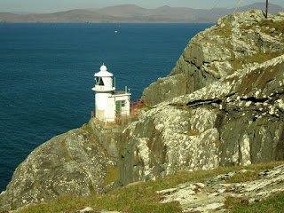
The view from the parking area is quite banal, so there is a 2km trail to the tip of Sheep’s Head, where there is a lighthouse.  We took the well-made path expecting to find a typical coastal lighthouse, only to come upon a mini lighthouse, it was hilarious.

Rather than walking back up the 2 km path to the parking area, we followed a path through some boggy ground, that then climbed up the hills from the tip of Sheep’s Head.  This was a pretty good walk and was about 5 km in total.

View from the end of Sheep's Head Peninsula

Mini Lighthouse near the tip of Sheep's Head Peninsula

View from Sheep's Head

As we got close to the parking area a sheep and her two lambs were right beside the trail.  The mother started to bleat for the lambs to get in gear and follow her.  They both got a bit bogged down in the tall grass and heather and made some pseudo bleating sounds, but then got their footing.  Since they were right beside us, but were on the verge of bolting off, we talked to them so that they stopped to stare and then we got a few good photos.

Sheep on Sheep's Head Peninsula

I had planned on going to Mizen Head, which is the extreme southwest point of Ireland, but we were fed up with slow roads by this time, so we went to Skibbereen to get some cheese and meat, then we had a cappuccino and drove back to Kenmare.

There are a lot of dairy cattle in Co. Cork, and it seems to be the dairy region of Ireland, as we have noticed that the majority of cheese we purchase comes out of Co. Cork.  All of the towns in the area are also very pretty, as well as rather tourist oriented.

We tried a Powers whiskey in the pub tonight, as the old guy we talked to in Achill drinks Powers and suggested we try it.  It is a lot better than Jameson, and more like a Scottish whisky.

The History of Ireland continues...

The Beginning of the ‘Troubles’

The Troubles is a term that is applied to the thirty-year period of sectarian violence in Northern Ireland.  In the mid 1960s, Reverend Ian Paisley, the founder of the Free Presbyterian Church, was on high alert for any politician who would betray Ulster, Unionism and Protestantism, by giving anything to the Catholics.  In 1968, Paisley forced the local constabulary to remove a flag of the Republic of Ireland, from a window in the Catholic sector of Belfast, rioting ensued for a period of four days.

Paisley drew support from working class Protestants whose jobs in heavy industry were falling away; they were angry with Union leaders and feared change.  At the same time, the Catholics were beginning to gain a level of assertiveness as they pursued secondary education and took up professional careers, although not in government, as those positions were for the Protestants.  The Catholics were not focussed on republicanism, rather, they were fed-up with blatant discrimination and the fact that they held few civic government council seats, even in Derry, which was predominately Catholic.

The Protestants viewed the civil rights complaints of the Catholics as just another strategy to end partition.  The Ulster Volunteer Force (UVF) re-formed in 1966, and some of their members fatally shot a young Catholic in Belfast, the killers were sentenced to life in prison and the UVF was banned.  This event was important, as it demonstrated that the Unionists would resort to violence.

The Catholics began to organize protest marches; when they marched in Derry, the constabulary went out of control and attacked the protesters, this was captured on film and broadcast to a shocked and outraged audience in the Republic of Ireland.

A group of students in a university in Belfast, calling themselves the People’s Democracy (PD) organized a protest walk in early 1969, from Belfast to Derry.  The walk started out with a small group, but gathered supporters along the way, including republicans.  The protesters were harassed by both Unionists and the constabulary.  Near Derry, the marchers were attacked and beaten by Protestants, which were organized by an associate of Paisley.

In August, the Royal Ulster Constabulary (RUC) wanted to enter a Catholic area of Derry, known as the Bogside.  The Catholics attempted to fend them off and the ensuring battle was filmed and broadcast to the world; the British army had to come in and put an end to the ‘Battle of the Bogside.’  Throughout 1969, rioting and killing ensued, to the point where the RUC used machine guns for crowd control in Belfast.  The British army had to come in and restore order; interestingly, British police forces refused to go to Northern Ireland to relieve the RUC.

The fact that modest reforms, such as ‘one man one vote’ exploded into such violence, demonstrated that the Protestants could not embrace any change, reform or inclusion of Catholics.  Northern Ireland was to protect and to promote the interests of the Protestants.  This ideology, along with the political structure of Protestant interests first, was the path to collapse.

More Route Maps

We keep forgetting to post our route maps.  The first map is our drive from Co. Donegal to Co. Mayo.  The second map is our long drive from Co. Mayo to Co. Kerry.  Unfortunately, we had to bypass a lot of wonderful countryside in Co. Galway and Co. Clare.

The south of Ireland is very different, as the towns are larger and all the towns and villages are very pretty and very tidy.  It feels much more urban here, busier and more populated.  There is also a larger variety of plant life here, as the land is more fertile.  We now know why our Airbnb host in Dublin told us that Donegal was 'wild and woolly.'   Of course, we love 'wild and woolly,' and we prefer the grittier places that are more rural.

Killygordon to Newport

Newport to Kenmare

Saturday 25 March 2017

Carrauntoohil Hike, Co. Kerry

Carrauntoohil is the highest mountain in Ireland, it is part of the mountain range known as the Macgillycuddy’s Reeks, I just love some of the names in Ireland.  Carrauntoohil is not that far from Kenmare, where we are staying; however, you generally cannot just drive across country and the highway from Kenmare to Killarney is closed right now, so we had to take a longer route.

A high pressure system has moved in and we were in for the best weather yet, full sun all day long with virtually no cloud and not much wind.  This was quite a change for us, and, the temperature got up to 19C, which is unreal.

The fine weather brought out a lot of walkers, so much so, that the parking lot was quite full.  We had to take curvy, single track roads to get to the trailhead.  There is nothing remote about trailheads in Ireland, as there was a farm there, with 2 Euro for parking, a tea room and a campsite.

There are several routes up Carrauntoohil, and we decided to take the shortest and busiest route, up the Devil’s Ladder.  The Devil’s Ladder is a very steep climb with loose rock and a lot of erosion.  It was a bit of a trial to ascend due to the boulders and loose scree, as well as water pouring down the rocks.  In some areas you have to scramble with your hands.

There is a rocky path prior to reaching the Devil’s Ladder, so this made for a longer walk than we have been accustomed to in the Irish mountains.  It took us about an hour and a half to reach the top of the Devil’s Ladder, then we had to take a steep climb up to the summit of Carrauntoohil, which took about 45 minutes.

You have to be a bit pig-headed to hike well and to be able to enjoy it.  Clearly, some people hate it and it is a slog for them.  We just decide we are getting to the summit and we don’t care what we have to endure to get there.  We never take any rest breaks until we reach the top, and as we get in shape, we just keep hiking faster.  However, today we could never get up enough speed to make it taxing with regard to cardio, because it was steep and the footing was marignal.

It was busy at the summit, and we have been spoiled by having mountains to ourselves recently.  However, the 360 degree views in full sun were spectacular.  I asked an older guy if he was local and he said not really as he lives in Wicklow.  I then asked him to point out the geography and then I got great suggestions on what not to miss in the area.

Then we talked to two young Irish guys who were not local either, they offered to take our photo and we discussed how beautiful Ireland is, and they also gave us suggestions of what to see.  The Irish are very forthcoming with information if you ask.  There seemed to be a lot of people from elsewhere in Ireland and some foreigners as well.

We spent about 45 minutes on the summit and truly appreciated our tea, and then we had to make our descent.  We figured that going down the Devil’s Ladder would be horrid, but it went really well, likely because we use hiking poles and because it is easier to pick out a route when looking down.  Also, there were fewer people on the trail.  People are hilarious, as we are all like sheep and will follow the people in front of us, up or down a trail.

Our Destination, the Steep One

Views from the Summit


Devil's Ladder

View from Devil's Ladder

We got back to the car around 4:00 pm, so the walk took us about five hours, including our summit break.  We decided to drive back to Kenmare through the Gap of Dunloe and through the Black Valley.  The Gap of Dunloe is a tourist attraction, as it is a very narrow and twisty road through a really cool gap in the mountains.  What happens, is that locals hitch a wagon to a horse and take tourists on a ride down the road, these are known as ‘jaunting cars.’  Luckily, it was late enough in the day so that the horse people were not operating, but the tourists were walking on the road, and for some reason, they are loathe to get out of the way, they are crazy.

It was quite the road to negotiate due to the walking people and oncoming cars, as there is only room for one car, so other cars have to move over or back up into passing places.  We stopped a few times to take photos, and then stopped at the very top of the road at the far end, where few people venture.

There was a guy there who was riding a Honda sports bike, so I asked him how his ride went.  He said the road had too sharp of turns to make it a good ride, I said well at least you are not riding a ‘Hog’ and he burst out laughing.  He is from Co. Clare and was down for a ride, we discussed places to see in Ireland, so we will be sure to go through the Conor Pass on the Dingle Peninsula in the days ahead.

Our drive through the Black Valley took forever, as it is a single track road with some really twisty sections.  When we finally reached Kenmare it was close to 6:00 pm so we rushed into the town centre to find a butcher.  We asked people on the street where to find the butcher, as there are a few, so we raced to one of the butcher shops and the butcher had most of his meat put away, but they are all about service.  He cut up beef and ground it for us and we bought some other stuff and talked about meat.  We are absolutely in love with Irish butchers.

Gap of Dunloe


The History of Ireland Continues....

In Northern Ireland, sectarian rioting in 1922 which left hundreds dead, mainly Catholics, had finally ceased.  Both Northern Ireland and the Irish Free State arose amid bloodshed.  The government structures of the two Irelands were similar.  However, the IRA wanted to destroy the state of Northern Ireland.  The Ulster Voluntary Force (UVF) was raised again in the 1920s and incorporated into a new paramilitary force to fight the IRA.

Life for Catholics in Northern Ireland was fairly abysmal as they were essentially excluded from power, 50% of the Unionist members held government office, while the Nationalist members of parliament were ignored or treated with contempt.  Education was split into well-funded Protestant schools and poorly funded Catholic schools.

The Free State of Ireland received a Constitution in 1937 which was ratified by the electorate.  Ireland was basically a republic in all but name.  After gaining control of her ports from the British a year later, Ireland was a sovereign nation.

During WWII, Ireland remained neutral as she could not declare with the British while retaining her sense of sovereignty.  However, Ireland was an important source of recruits, labour and food for Britain during the war.  Many Irish went to Britain for work during the war and post WWII, emigration to Britain remained high, as the Irish economy was lethargic, and there was little increase in manufacturing.

The 1960s was a much better decade for the Republic, they achieved economic growth and emigration levels finally dropped.  Another important development was the granting of free secondary education to all, which dramatically improved the level of education.

In 1949, Ireland withdrew from the Commonwealth and declared a republic.  The IRA was active in the 1950s, they wanted to end partition and would do so with violence.  To that end, the IRA raided British army bases to gather weapons.

The Northern Ireland Catholic minority was indifferent to the IRA, as they were benefiting from the British welfare state.  The economy of Northern Ireland was modernizing, but they did not give any consideration to the political situation.  Political reform was necessary, as society was deeply divided and sectarian; however, the issue was not addressed, and this would have important ramifications for Northern Ireland.